


writing | Edges
Sitting on the summit of Ysgyryd Fawr, tracing the hills on the horizon.

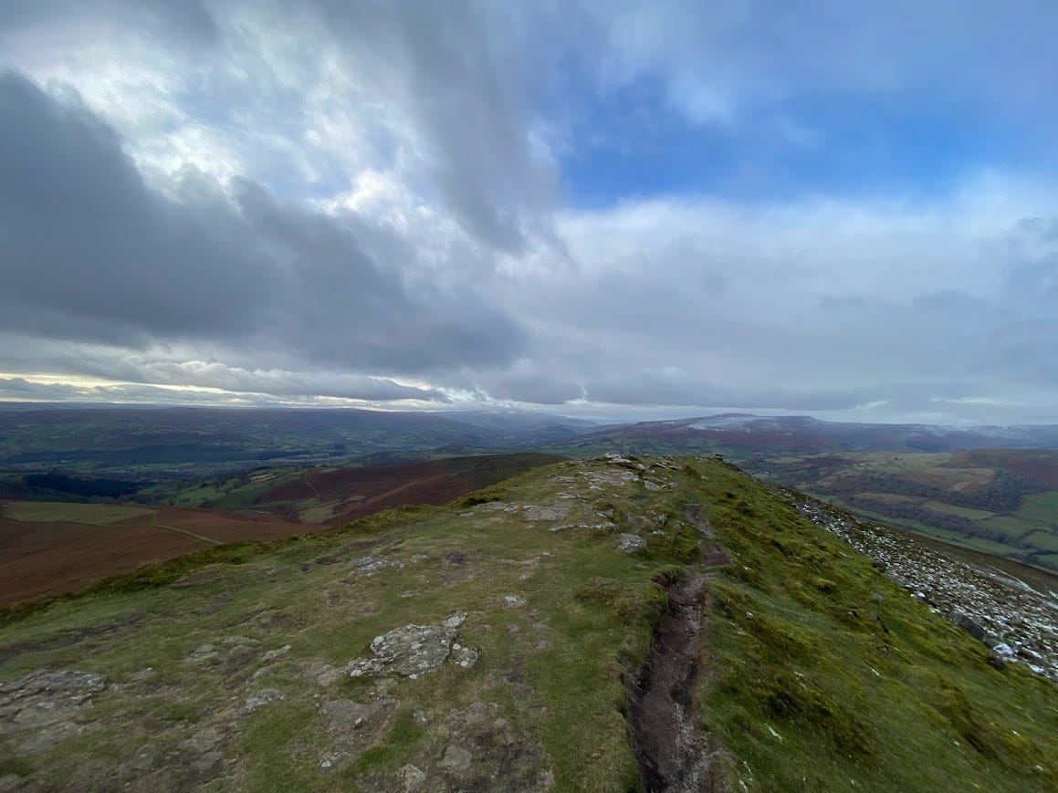
Ysgyryd Fawr stands at 486m. To some, it's a pleasant walk, and to others a mountain gained with effort. On a clear day, it offers rich rewards.
From my front door to the trig point takes me just over an hour. It's a warm evening and I have a thin cover of sweat from the steep ascent through the woods. On the open ridge, there is enough of a breeze to cool me down.
Soft cotton clouds hang in the sky, and shades of pale blue grow deeper the higher you gaze upwards. As I sit and look south down the ridge, I can trace the edges of the hills and mountains in front of me.
The round lump of Blorenge is at the far end of the valley. Peeking out from behind it is Coety Mountain with its twin summits of Mynydd Farteg Fawr and Cefn Coch. There are two scoops out the side of Blorenge. The bigger, Cwm Craf, is the main route up from Llanfoist, and one that some choose to charge up the steep back wall. The smaller scoop is known as Punchbowl and is home to a beautiful nature reserve.
Moving west is Gilwern, where limestone quarries were dug out maybe 150 years ago, leaving a scar on the landscape. Behind Gilwern you can make out the old tips of the Blaenovan pit.
Through the valley, the river Usk has carved its way from the Black Mountains in the west and down to Abergavenny. Here it meets the river Gavenny and flows down to Newport and the Severn estuary.
On the other side of the valley is the rounded spur of Deri. Covered in thick lush oak woods, the long lump gives way to bare open space covered in bracken. The saddle of Deri meets up with Pen-Y-Fal, the most obvious peak in the area. At 596m it stands alone from the other hills because it resembles a volcano.
Behind Pen-Y-Fal and further west I can view the rolling hills and moorland of the Brecons as well as the familiar Table Mountain. An old fort above Crickhowell, its flat top is easy to pick out. From there I can trace a line up to Pen Cerrig-calch at 701m.
Slowly moving my gaze north and closing in my focus, I look down to the tiny humpback shape of Bryn Arw. Its east flank is covered in terraces where a project to plant and grow trees is underway. The undeniable benefits that this tiny hill will bring are enormous.
As I trace the landscape further north I can make out the Black Mountains range and Vale of Ewyas. A long valley flanked by broad hills, this is border territory. Offas Dyke runs up from Pandy to Hatterall Hill, and for around 15 kilometres there is nothing but space and air and views.
Surveying the valleys and cwms I imagine the vast seas of ice slowly moving through, carving out what I see today. As I finish tracing the lines I close my eyes and listen to the birds and sheep. To the bracken and grass rustling. To the distant hum of traffic and the rattling of a passing train.
After a while, I hear voices. A crowd of walkers have made the same pilgrimage to the top. They stand and take photos, smiling and happy as they've earned this moment. They see me and smile and I wave back.
I look back out to the hills and spot a kite hovering just above me, maybe 20 metres away. It swoops away on the streams and I lose sight of it amongst the edges of colours unfolding below.